Alcazaba in Alhambra, Granada (7076755831).jpg
From Warlike Expounder
File:Alcazaba in Alhambra, Granada (7076755831).jpg
Original file (3,739 × 2,483 pixels, file size: 6.36 MB, MIME type: image/jpeg)
.jpg)
Summary
| Description |
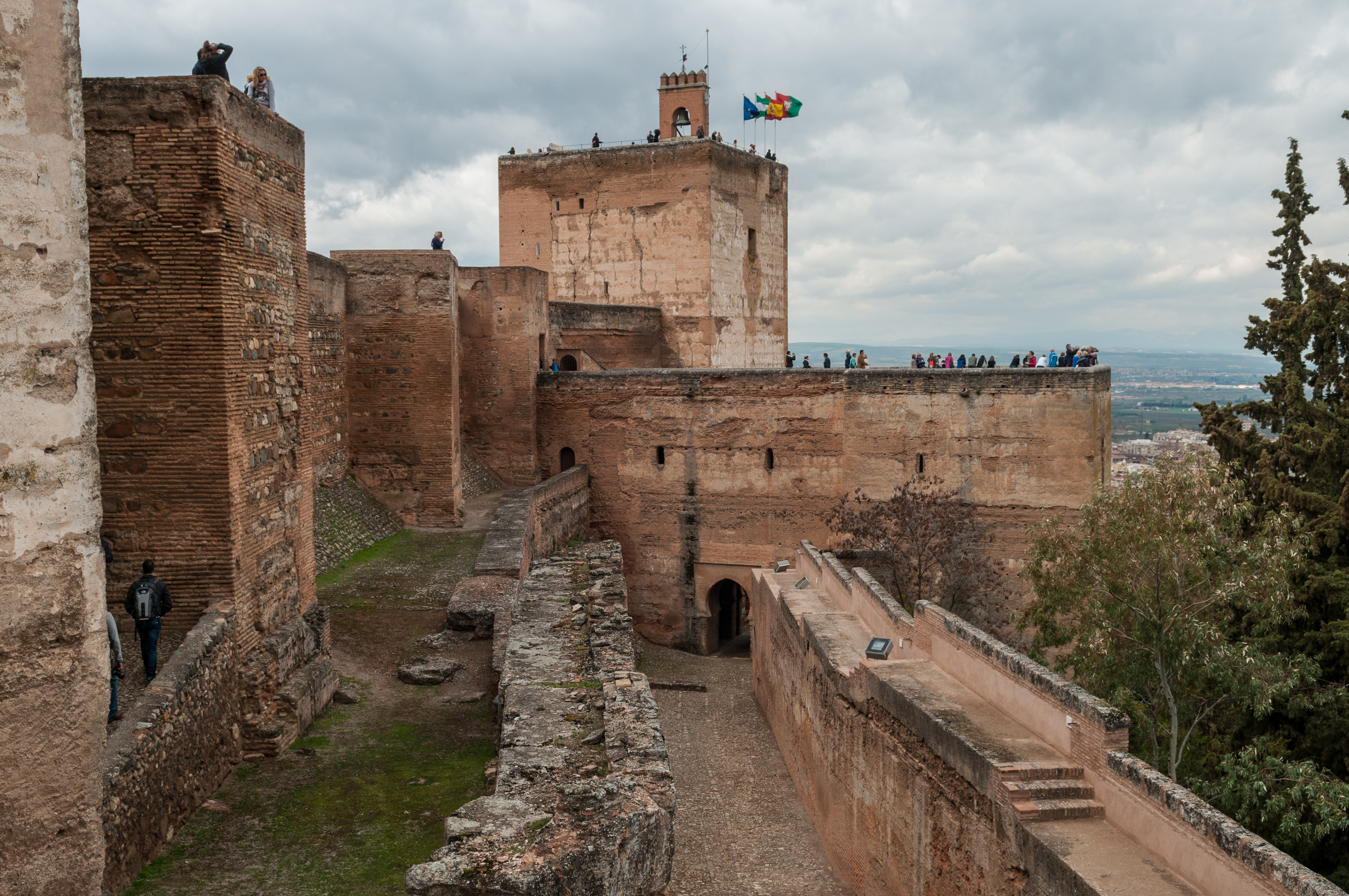
Alhambra, the complete form of which was Calat Alhambra (الْقَلْعَةُ ٱلْحَمْرَاءُ, trans. al-Qal‘at al-Ḥamrā’, "the red fortress"), is a palace and fortress complex located in Granada, Andalusia, Spain. It was constructed during the mid 14th century by the Moorish rulers of the Emirate of Granada in al-Andalus, occupying the top of the hill of the Assabica on the southeastern border of the city of Granada. The Alhambra's Moorish palaces were built for the last Muslim Emirs in Spain and its court, of the Nasrid dynasty. After the Reconquista (reconquest) by the Reyes Católicos ("Catholic Monarchs") in 1492, some portions were used by the Christian rulers. The Palace of Charles V, built by Charles V, Holy Roman Emperor in 1527, was inserted in the Alhambra within the Nasrid fortifications. After being allowed to fall into disrepair for centuries, the Alhambra was "discovered" in the 19th century by European scholars and travelers, with restorations commencing. It is now one of Spain's major tourist attractions, exhibiting the country's most significant and well known Islamic architecture, together with 16th-century and later Christian building and garden interventions. The Alhambra is a UNESCO World Heritage Site, and the inspiration for many songs and stories. Alhambra. (2012, April 10). In Wikipedia, The Free Encyclopedia. Retrieved 15:33, April 14, 2012, from en.wikipedia.org/w/index.php?title=Alhambra&oldid=486... |
| Date | |
| Source | Alcazaba in Alhambra, Granada |
| Author | Michal Osmenda from Brussels, Belgium |
| Camera location | | View this and other nearby images on: OpenStreetMap |
|---|
.jpg¶ms=037.177047_N_-003.591617_E_globe:Earth_type:camera_source:Flickr_&language=en-gb)
Licensing
- You are free:
- to share – to copy, distribute and transmit the work
- to remix – to adapt the work
- Under the following conditions:
- attribution – You must give appropriate credit, provide a link to the licence, and indicate if changes were made. You may do so in any reasonable manner, but not in any way that suggests the licensor endorses you or your use.
| This image, originally posted to Flickr, was reviewed on 3 February 2013 by the administrator or reviewer File Upload Bot (Magnus Manske), who confirmed that it was available on Flickr under the stated license on that date. |
File history
Click on a date/time to view the file as it appeared at that time.
| Date/Time | Thumbnail | Dimensions | User | Comment | |
|---|---|---|---|---|---|
| current | 03:37, 3 February 2013 | | 3,739 × 2,483 (6.36 MB) | wikimediacommons>File Upload Bot (Magnus Manske) | Transferred from Flickr by User:russavia |
File usage
The following page uses this file:
.jpg)